![Hallasan National Park [UNESCO World Heritage] (한라산국립공원 [유네스코 세계자연유산])](https://image.kpopmap.com/2020/03/601659_image2_1.jpg)
Introduction
Hallasan Mountain stands proudly at the center of Jeju Island and is perhaps the island’s most memorable landmarks. Also called Yeongjusan Mountain, meaning “mountain high enough to pull the galaxy,” Hallasan Mountain is widely known by scientists for its geological value. Designated as a national park in 1970, there are 368 parasitic volcanoes called Oreums (peaks) around the main mountain.
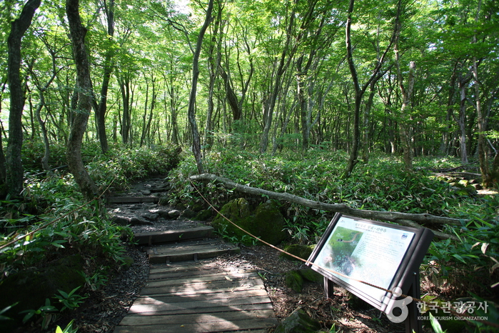
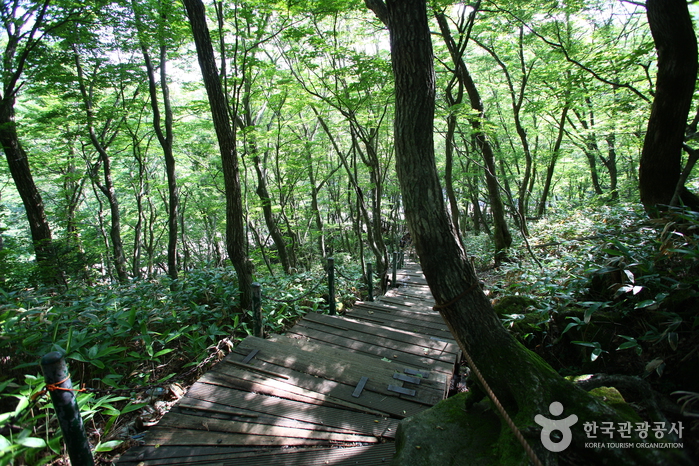
Hallasan Mountain is famous for its vertical ecosystem of plants that results from the varying temperatures along the mountainside. Over 1,800 kinds of plants and 4,000 species of animals (3,300 species of insects) have been identified; to explore the mountain’s treasures, simply follow one of the well-developed mountain hiking trails.
Hallasan Mountain is relatively easy to hike. With hiking courses less than 10 kilometers in length, it is possible to go to the peak and back in one day. However, the constantly changing weather brings a lot of wind, so visitors must be well prepared before hiking.
Address:
2070-61, 1100-ro, Jeju-si, Jeju-do[Google Map]
Closed:
N/A (Open all year round)
Homepage:
geopark.jeju.go.kr (Korean, English, Japanese, Chinese)
How To Use
Parking Facilities:
Available (6 parking lots)
Cars 1,800 won / Buses 3,000 won (11-15 passenger buses), 3,700 won (16 and more passenger buses) / Two-wheeled vehicles 500 won / Compact cars 1,000 won
Transportation
[Bus]
Jeju Intercity Bus Terminal – Eorimok
-Take Bus No. 740 (Jeju, Yeongsil, Jungmun), and get off at Eorimok Trail Entrance Bus Stop.
Travel time: approx. 45 min
Jeju Intercity Bus Terminal – Seongpanak
-Take Bus No. 781 or 781-1 (Jeju, Seongpanak, Seogui), and get off at Seongpanak Bus Stop.
Travel time: approx. 40 min
Additional Info
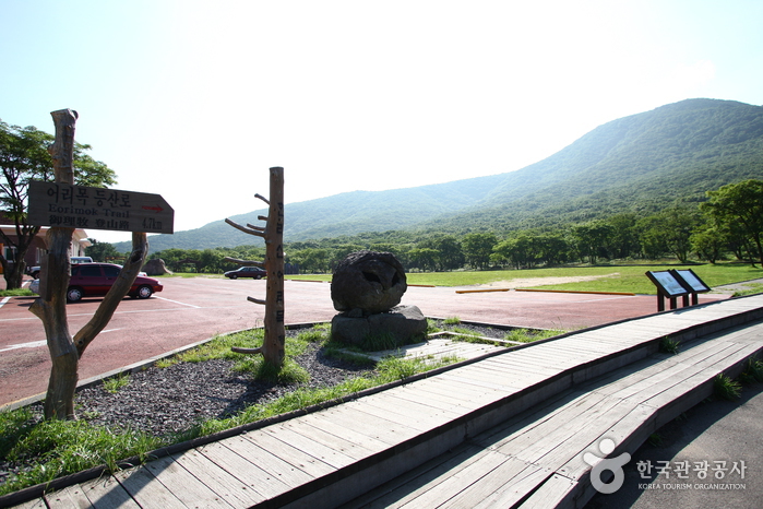
Hiking Course:
[Yeongsil Trail] 5.8km
Yeongsil Rest Stop – Byeongpungbawi Rock – Uitse Oreum – Nambyeok Point
[Gwaneumsa Temple Trail] 8.7 km
Gwaneumsa Camping Site – Tamna Valley – Gaemideung – Samgakbong Peak Shelter – Summit (Dongneung)
[Seongpanak Trail] 9.6 km
Seongpanak Trail Information Center – Sokbat Shelter – Saraak Oreum Entrance – Azalea field – Summit (Dongneung)
[Donnaeko Trail] 7 km
Donnaeko Trail Information Center – Pyeonggue Shelter – Nambyeok Point
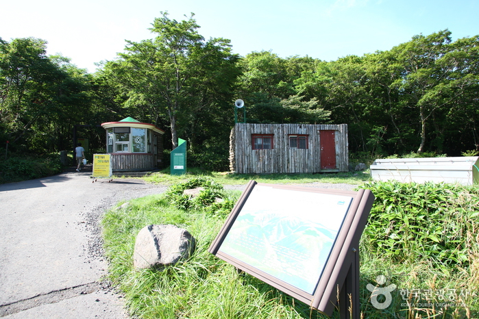
[Eoseungsaengak Trail] 1.3 km
Eorimok Trail Information Center – Eoseungsaengak
[Seokguram Trail] 1.5 km
Chunghon Memorial Site parking lot – Seokguram
Mountain Not Access Period:
Hiking hours subject to change according to season and park rangers’ discretion.
For detailed information, please visit the official website.
Available Facilities:
Campsite (Gwaneumsa Temple area), hiking trails, mountain shelters, visitor center (entrance of Eorimok Trail), restrooms
Admission Fees:
Free
Facility Utilization Fees:
[Campsite Fees]
Small (for 3 people or fewer): 3,000 won
Medium (for 4-9 people): 4,500 won
Large (for 10 people or more): 6,000 won
[Shower Facility]
Adults 600 won / Teenagers 400 won/ Children 300 won
Facilities for the Handicapped:
Designated restrooms and parking spaces
Restrooms:
Available
tel: +82-64-710-3945
zipcode: 63077
heritage1: 1
infocenter: • 1330 Travel Hotline: +82-2-1330
(Korean, English, Japanese, Chinese)
• For more info: +82-64-710-3945